


Piri Reis

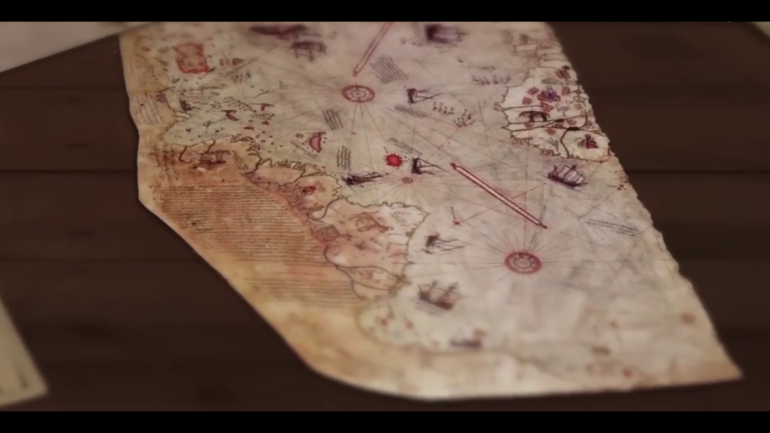
In 1513, a Turkish cartographer drew a mysterious map of the world. This map depicted the unexplored lands of the world of the time, its various routes and the animals living in these lands. Moreover, the map was created before Magellan’s famous expedition proved that the Earth was round.
Found in 1929 in Topkapı Palace, the map, drawn on a 90/60 cm parchment, was, according to the notes on it, part of a large-scale world map drawn by Piri Reis in 1513 in Gallipoli and presented to Yavuz Sultan Selim in Egypt in 1517.
Piri Reis’ World Map was very different from its contemporaries. In the map drawn with unprecedented scale and perspective, Piri Reis perfectly illustrated the coasts of the Americas, which had been discovered 20 years before, and included the whole of South America.
Piri Reis’ world map was drawn with a perfect and scientific mindset for its time, and it also has a special historical value as it is the only map drawn using Christopher Columbus’s map, which no longer exists in its original or copied form.
Piri Reis did not limit himself to maps. Believing that no matter how large-scale maps were, it would be impossible to include all the necessary information, he recognized the need for a maritime guide. To address this, he wrote his famous work Kitab-ı Bahriye (The Book of Bahriye), a guide for sailors detailing coasts, islands, and harbors.
Piri Reis not only created one of history’s most extraordinary world maps but also wrote one of the most important books on maritime geography. For nearly a century, Piri Reis and the surviving piece of his map have been the subject of debate, and will continue to be so in the future.